|
Iraq's Weather Forecast for the Coming Days
2025-12-26

The Meteorology Department at the Upper Euphrates Center for Sustainable Development Research – University of Anbar – announced the latest satellite imagery updates for the weather forecast for the coming days. An extreme upper-level negative system is expected, indicating a significant drop in surface temperatures, a frontal low, and rainfall and snowfall in central and northern Iraq. Assistant Professor Dr. Ahmed Jassam Mukhlif, climate expert and head of satellite meteorology at the center, stated that the weather forecast for the coming days will be as follows, and Allah knows best:
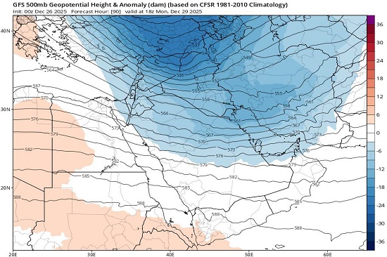
500mb Upper Atmosphere Dynamic Analysis
Indicates a strong negative anomaly extending from the north and northeast at the 500 millibar pressure level. This anomaly means that the stroboscopic height is below normal levels, indicating the presence of a cold air mass. Very (cold upper-level trough) in the upper atmosphere.
The low-pressure system's movement shows a sharp trough extending deep southward. This trough is bringing cold winds from higher latitudes toward the region. The center of the coldest air mass is concentrated over Turkey and northern Iraq (values ??of 537-540 decameters), which indicates a significant drop in surface temperatures.
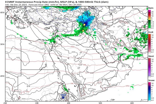
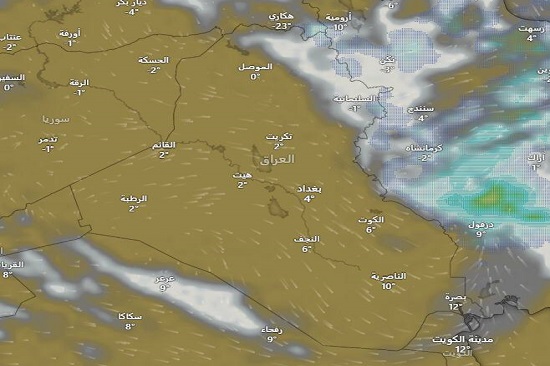
Surface Pressure and Precipitation Systems Analysis (MSLP) & Precipitation
A fully developed frontal low is strongly affecting the north (rain and snow) and the central region (scattered rain and hail) due to low thickness values ??(500-1000 mb). If the system intensifies, snowfall is expected in the northern parts of Anbar and may reach even lower levels. The effect of moisture diminishes as we move south, replaced by the influence of a polar air mass (Cp), which will cause a sharp drop in minimum temperatures in the central and southern regions.
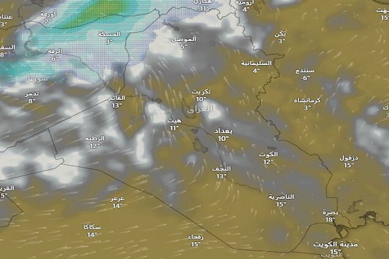
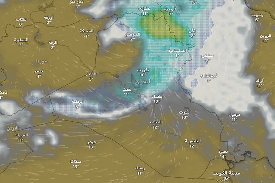
Temperatures
God willing, a significant drop in temperatures is expected in the Levant, Iraq, northern and central Saudi Arabia, and the Gulf countries (Kuwait, Qatar, Bahrain, and the UAE later) as a result of the penetration of these polar winds. We are facing a strong cold wave that will affect – God willing – the Levant, Iraq, and the northern and eastern half of the Arabian Peninsula at the end of December. The peak of the wave will be between December 28th and 30th, when a very cold upper-level trough will deepen over Iraq, the Levant, and northern Saudi Arabia, causing temperatures to reach their lowest levels. There is a high probability of frost formation in desert and exposed areas, requiring preparation for a significant drop in temperatures. This cold wave will last for four days, with a gradual retreat beginning on January 1st. The polar air mass will start moving eastward (towards Iran and Afghanistan), which will lessen the intensity of the upper-level cold, but surface cold will remain strong, making these areas very cold, especially at night.
We are facing a strong surface cold wave that will affect the Levant, Iraq, and the northern and eastern half of the Arabian Peninsula at the end of December. Over the next 10 days, God willing, temperatures will range as follows:
Mountainous Region:
Maximum (-4 to -1)°C
Minimum (-9 to -7)°C
Northern Iraq
Maximum (3 to 7)°C
Minimum (-3 to 1)°C
Central Region
Maximum (7 to 13)°C
Minimum (-1 to 5)°C
Southern Region
Maximum (9 to 11)°C
Minimum (12 to 18)°C
Allah knows best and grant success and guidance.
#university_of_anbar
#Upper_Euphrates_Center_for_Sustainable_Development_Research
|