|
A complex spring weather disturbance will bring a week of intense lightning and flash floods to the country
2026-04-25

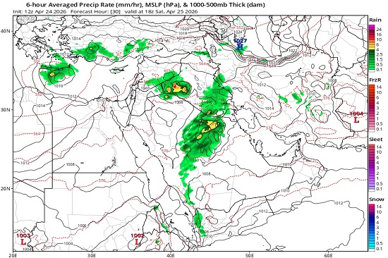
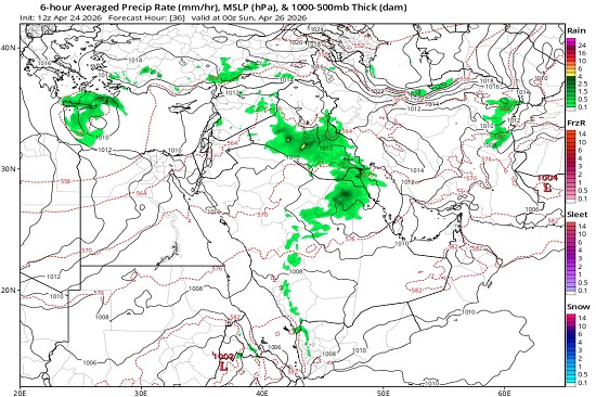
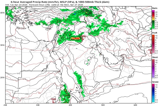
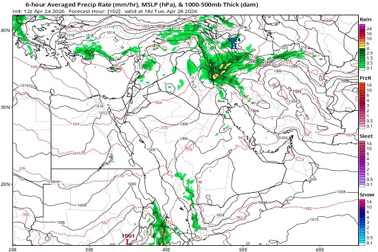
The Meteorology Department at the Upper Euphrates Center for Sustainable Development Research, University of Anbar, announced the latest satellite weather updates. Assistant Professor Dr. Ahmed Jassam Mukhlif, Head of Satellite Weather Forecasting, stated that, according to the latest updates from global numerical models (ECMWF & GFS), the entire country is expected to be affected by a complex and highly effective weather system. This system is resulting from the convergence of the seasonal Sudanese low-pressure system (surface thermal) with a deep upper-level cold trough.
This convergence creates a state of severe atmospheric instability due to sharp vertical temperature differences. The low-pressure system is expected to reach a historically high intensity, peaking on Tuesday at 1002 hectopascals (hPa). This low temperature will act as a powerful catalyst for attracting tropical moisture, leading to the formation of massive cumulonimbus clouds accompanied by violent lightning, large hail, and strong downdrafts. Thunderstorms are also expected. If this weather pattern persists and intensifies, it will contribute to replenishing water reserves, but requires full awareness of the risks associated with thunderstorms and flash floods. This weather pattern is expected to continue from Saturday to Thursday, April 25-30, 2026, with the following effects:
- Northern Region (Nineveh, Dohuk, Erbil, Kirkuk, Sulaymaniyah) Thermal Pattern: A sharp drop in temperatures; the maximum temperature will fall from 30°C to stabilize at 20°C.
Rainfall: Very heavy, intermittent rain, with a peak of strong thunderstorms on Monday and Wednesday. Heavy hail (hailstones) of large sizes is expected, with a very high risk of flash floods in valleys and mountainous areas.
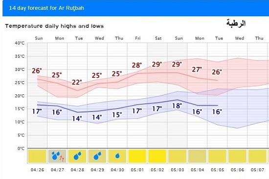
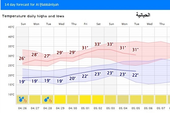
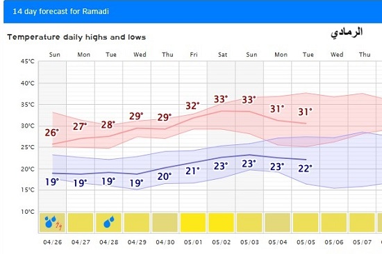
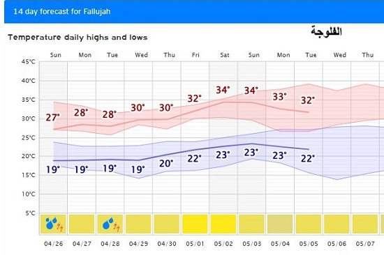
- Western Region (Rutba, Ramadi, Al-Qaim, Rutba)
Temperature Pattern: This region will be the first to be affected by the cold air mass, with Rutba recording the lowest high temperature at 21°C.
Winds: Strong downdrafts from cumulonimbus clouds exceeding 60 km/h, with the formation of wall dust storms preceding the rain, and heavy thunderstorms concentrated at the beginning and end of the weather system.
- Central Region (Baghdad, Salah al-Din, Diyala, Middle Euphrates)
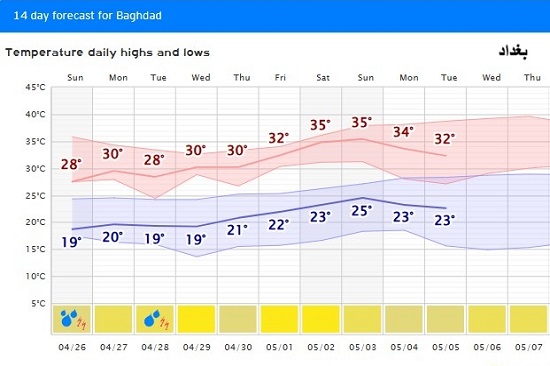
Temperature Pattern: Very mild spring-like weather during the day, 24-27°C, and possibly pleasant at night due to cloud cover.
Rainfall: Widespread thunderstorms characterized by high intensity rainfall over short periods. With intense thunderstorms and the possibility of flash runoff events, especially in cities, due to water accumulation in tunnels and low-lying areas, caution is advised.
- D- Southern Region (Basra, Nasiriyah, Maysan, Muthanna)Thermal Pattern: A less severe drop in temperatures, with highs ranging between 29-31°C, and a noticeable increase in relative humidity, which may lead to near-humid conditions.
Winds: Active southeasterly winds stirring up dust.
Rainfall: Scattered thunderstorms, with a risk of flash floods in the eastern border regions (Maysan and Wasit).
Recommendations:
- Hydrological Aspect: Caution is advised regarding flash floods in valleys and eastern and northern border regions.
- Structural Safety: Secure loose objects and tower cranes due to the expected strong downdrafts, especially on Tuesday.
- Agricultural Sector: Take precautions against heavy hail, which may damage seasonal crops (wheat and barley).
- Public health: Be aware of sharp temperature fluctuations between day and night to avoid catching seasonal colds.
#university_of_anbar
#Upper_Euphrates_Center_for_Sustainable_Development_Research
#SDG13
|