| News Details |
Very important// The volume of harvesting flood water in the western region through satellite images
2023-01-13

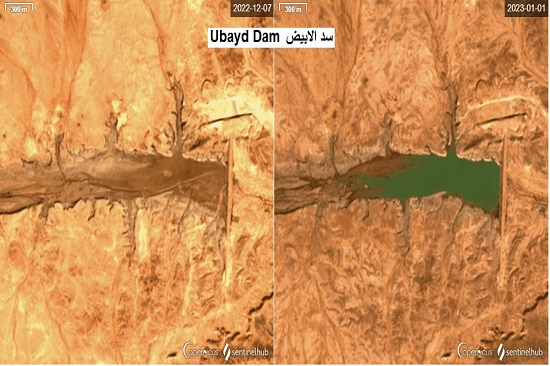
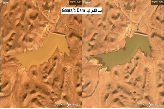
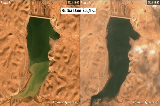
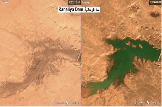
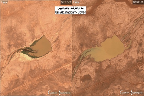
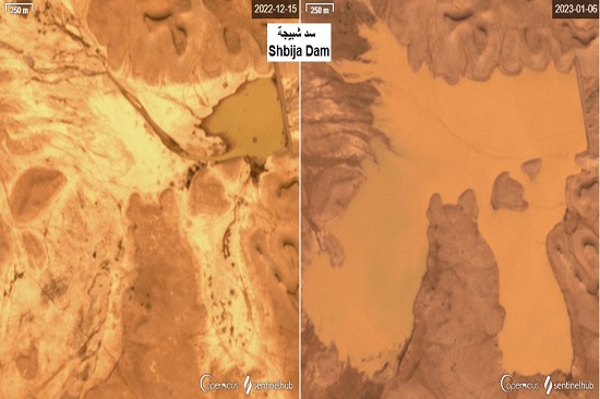
The Planning and Databases Department at the Upper Euphrates Basin Developing Centre / University of Anbar obtained satellite images documenting the volume of storage in the dams of the western region as a result of the wave of floods during the months of (December - 2022) and (January - 2023). Images obtained through ESA satellites showed that most of the dams' reservoirs along the Western Desert have received very good quantities of water, through which they have enhanced the volume of storage in these dams from Horan in the north and northwest of the region to the dams of El Abyadh valley in the south.
The dams of Rutba, Horan / 2 and Al-Abila on Horan, as well as the dams of Al-Ga'ara/4 on the Ga'ara depression, the Shabija Dam on Wadi Al-Ghadaf, Al-Abyad Dam and um Al-Tarfat are among the most dams that received torrents that enhanced the water storage of the region, in addition to the Al-Rahhaliya Dam, which was completely filled and the water crossed over the dam's spillway.
The Planning and Databases Department at the Centre, through the efforts of the Haditha terminal station's staff of the Centre and the direct cooperation of the Resident Engineer Department for Small Dams in the Western Region of the General Authority for Dams and Reservoirs at the Ministry of Water Resources, was able to record and document most of these dams and draw the water curve (Hydrograph) for these rainstorms and floods in the valleys of the region, enhanced by measuring the amounts of rain for three stations: Rutba, Haditha and Ramadi, this provides databases enhanced by actual field and field measurements for graduate students, researchers and designers of dam projects, water harvesting and water resources management, in addition to decision-makers, government departments and ministries interested in investing, enhancing and developing the region, which is achieved for the first time in 47 years.
#university_of_anbar
#Upper_Euphrates_Basin_Developing_Center