| News Details |
Weather Updates and Details of the Dust Storm and its Origin
2026-01-13
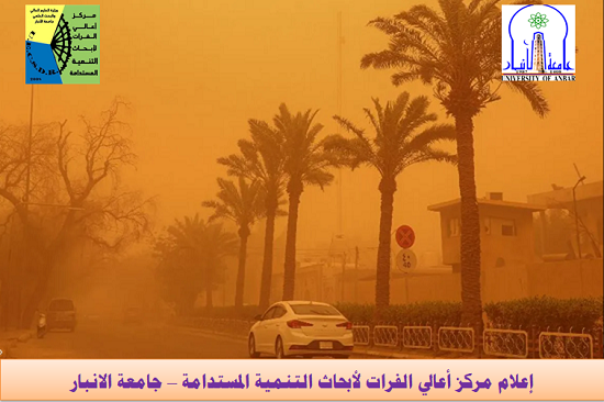
The Meteorology Department at the Upper Euphrates Center for Sustainable Development Research, University of Anbar, announced the current weather updates for Tuesday, January 13, 2026. Assistant Professor Dr. Ahmed Jassam Mukhlif provided the following details about the dust storm and its origin:
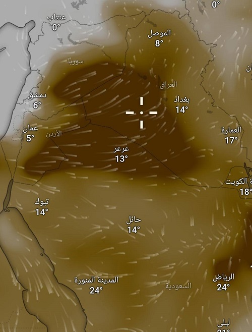
Storm Origin and Path:
The map clearly shows that the source of the dust is concentrated in the western region of Iraq (Anbar Desert) and the Iraqi-Syrian and Iraqi-Saudi borders.
Primary Source:
The storm began as a result of strong southeasterly winds (exceeding 50-60 km/h) originating from a low-pressure system coming from the Mediterranean Sea.
Wind Movement:
These strong downdrafts stirred up dust from the fragile desert areas in the west and southwest, and then pushed beyond Anbar towards Baghdad, Karbala, Najaf, and the southern region. Dust density: Zero horizontal visibility (less than 1000 meters). Temperatures: A significant drop is observed, with Mosul recording 8°C and Baghdad 14°C, indicating the collision of a cold front with active winds, which increases the storm's intensity. Forecast for the coming hours: A gradual decrease is expected, God willing. The storm is expected to begin gradually receding during the late hours of Tuesday night and early Wednesday morning. Rainfall: God willing, this dust storm will be followed by rainfall in the northern and central regions, which will help to clear the air and settle the suspended dust.
Safety recommendations:
It is strongly advised to keep windows completely closed, avoid going outside if you have respiratory problems (asthma), and use face masks.
We ask Allah for protection and safety for all.
#Upper_Euphrates_Center_for_Sustainable_Development_Research