| News Details |
Iraq's Weather Forecast for the Coming Days
2026-05-17
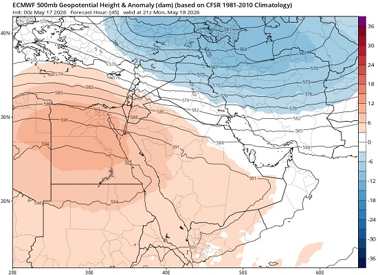
The Meteorology Department at the Upper Euphrates Center for Sustainable Development Research, University of Anbar, announced the latest satellite weather updates. Assistant Professor Dr. Ahmed Jassam Mukhlif, Head of Meteorology at the Center, stated that, based on the attached numerical weather prediction map issued by the European model (ECMWF) at the 500 millibar level (500mb Geopotential Height & Anomaly), Iraq will be under the influence of two weather systems on Monday and Tuesday, May 18-19, 2026:
One is a surface Mediterranean low-pressure system accompanied by a northeastern trough, which is dominating the northern and northeastern regions of the country and may therefore experience thunderstorms on Monday and Tuesday.
The other is a subtropical high-pressure system located in the southwest of the country.
This means that Iraq, particularly the central and southern regions, will be under the influence of the frontal line between these two weather systems, with active westerly to northwesterly winds reaching speeds of 45-55 km/h.
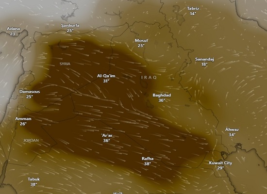
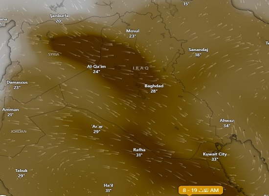
Effects: This may lead to the formation of dust storms originating from desert regions, especially the Syrian and Jordanian deserts, potentially reducing visibility.
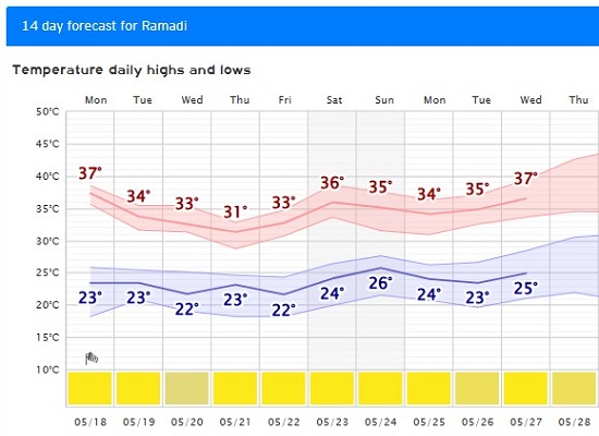
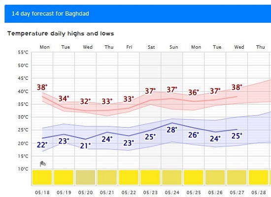
Temperatures: Relatively hot weather will persist in southern and central Iraq under the influence of the high-pressure system, while temperatures will tend towards moderation in the north. There is a chance of cloud formation due to the moisture associated with the edges of the upper-level trough, as the curves clearly indicate the final transition from spring to actual summer in Iraq. This transition is characterized by moderate temperature fluctuations (appearing in the mid-week drop), followed by the complete and continuous dominance of the subtropical high-pressure system, with a significant temperature difference (approaching 15°C) between the north and south of the country.
#Upper_Euphrates_Center_for_Sustainable_Development_Research