| News Details |
The Upper Euphrates Center Publishes Satellite Images of Several Dams in Western Iraq
2026-04-19
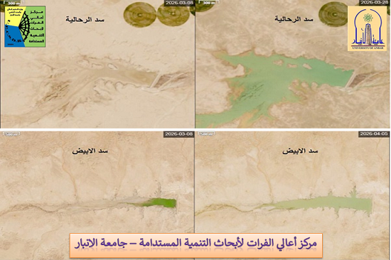
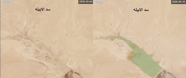
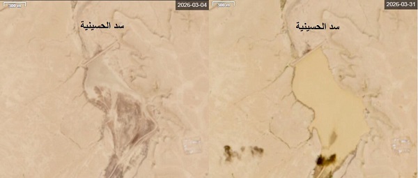
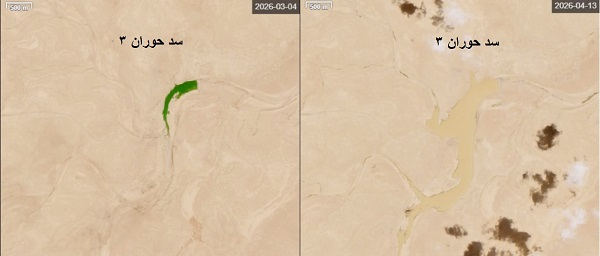
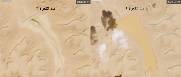
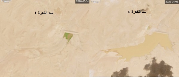
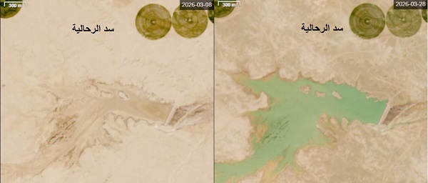
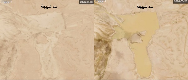
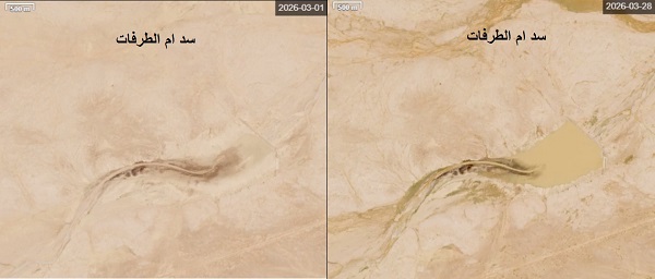
The Planning and Databases Department at the Upper Euphrates Center for Sustainable Development Research at Anbar University announced the publication of a collection of satellite images taken by a European satellite of several dams in western Iraq, documenting the effects of the rainfall wave that affected the region during March 2026.
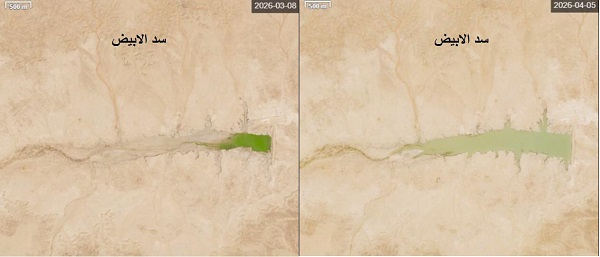
Engineer Ahmed Ismail explained that the images included ten dams distributed across a wide area of ??Anbar Governorate, showing several of them at 100% capacity, including the Rahaliya Dam, where eyewitnesses confirmed water flowing from its spillway, in addition to the dams in the Ka'ara area, particularly Ga'ara 4 and Ka'ara 2 dams. In contrast, the remaining dams recorded high water levels approaching their design capacities, most notably the Al-Abyad Dam, which has a capacity of the design capacity is approximately 25 million cubic meters.
He added that the images revealed important indicators related to the structural and operational condition of some dams, including an increase in the surface area of ??the reservoirs due to excavation or soil extraction from accumulated sediment and its transport to other areas. This has led to collapses in the abutments of some reservoirs and an increase in the water surface area, negatively impacting storage efficiency due to increased evaporation losses, as clearly shown in the images of the Shabija Dam.
The images of the Aghri Dam also showed a possible sinkhole problem, as a significant loss of water was observed inside the reservoir. This necessitates continued maintenance and repair work, particularly cement grouting to reduce leakage. For his part, Assistant Professor Dr. Atheer Salim Obaid, Head of the Planning and Databases Department, affirmed that the department is continuing to implement its programs aimed at developing and expanding databases, not only through collecting measurements and statistics, but also through conducting research studies and proposing solutions and treatments, in cooperation with relevant entities, including the Resident Engineer's Office for Small Dam Projects in the Western Region, affiliated with the General Authority for Dams and Reservoirs at the Ministry of Water Resources.
Professor Dr. Ammar Hatem Kamel pointed out that the use of remote sensing and satellite technologies is an effective tool in supporting monitoring and follow-up, especially for small dam projects located in remote areas. This contributes to providing accurate data that supports operation and maintenance teams and enhances the efficiency of water resource management.
The center called on the relevant authorities and decision-makers in Anbar Governorate to prioritize investing in these projects and regulating their operation in a way that contributes to expanding green spaces, improving the environmental situation, and developing local resources. This plays a vital role in achieving the Sustainable Development Goals, in line with the University of Anbar's vision of serving the community and supporting the Sustainable Development Goals 2030.
#Upper_Euphrates_Center_for_Sustainable_Development_Research