| News Details |
Extremely Dangerous Floods Detected Along the Tigris River Basin in Iraq, with Diyala Governorate at the Highest Risk Point
2026-04-26
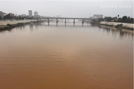
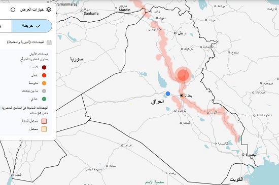
The Meteorology Department at the Upper Euphrates Center for Sustainable Development Research, University of Anbar, announced the detection of a high-risk flood event along the Tigris River basin. This event was documented through the analysis of data from multispectral sensors carried on satellites, which allow for the monitoring of changes in surface water levels and the extent of flooding with high spatial and temporal accuracy.
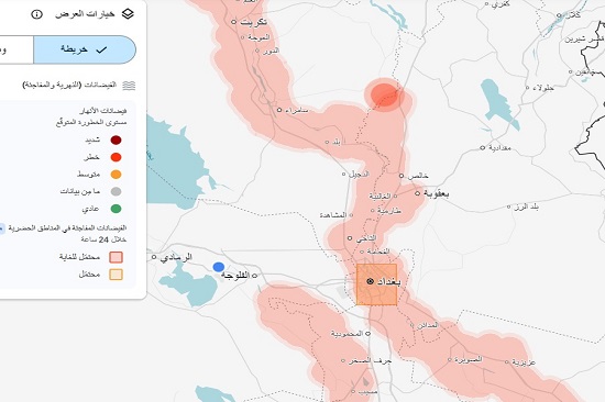
Data obtained from the analysis of multispectral satellite imagery revealed that the Tigris River is experiencing a continuous, strip-like flooding extending from Nineveh Governorate in the north, through Kirkuk and Salah al-Din Governorates, and south to beyond Baghdad. Diyala Governorate stands out as the hotspot with the highest spectral density according to the NDWI (Differential Standard Water Index), with values ??exceeding the critical threshold for the region on the hydrological intensity index, necessitating urgent response measures.
First: Classification of Affected Areas According to Observed Risk Level
Governorate ----- District ------ Risk Level ------ Nature of Observed Event
Diyala/ Very Severe/ Highest Spectral Intensity Focus According to the NDWI (Differential Standard Water Index)/ Exceeding the Critical Threshold
North Baghdad and Suburbs/ High/ Flooding Extends Along Both Banks
Nineveh — Kirkuk — Salah al-Din/ High/ Extended Strip-Shaped River Floods
Kut — Amarah/ Moderate (Real-Time Monitoring)/ Tigris River Levels Gradually Rising
Second: Urgent Warning — Flash Floods in Urban Areas
The results of time-lapse spectral analysis of satellite imagery indicate a significant increase in the probability of flash floods in urban areas adjacent to the Diyala Basin and the Tigris River, within a critical timeframe not exceeding 24 hours from the date of this bulletin.
Third: Scientific and Procedural Recommendations
In light of the data obtained from the remote sensing monitoring system, the Upper Euphrates Center for Sustainable Development Research at Anbar University recommends the following:
- Raising the operational readiness of civil defense agencies in governorates classified as high-risk and taking the necessary precautions to deal with anticipated flood scenarios.
- Activating emergency evacuation plans for population centers located on exposed flood banks, prioritizing densely populated areas.
- Strengthening the network of field hydrological measurement stations along the Tigris River and its tributary, the Diyala, and ensuring their continuous and immediate operation.
- Immediate coordination with the Iraqi Meteorological Organization and Seismological Survey to monitor water levels in real time and exchange hydrological data among relevant authorities, as these areas are also expected to receive rainfall exceeding their annual average during the current low-pressure system affecting the country.
#Upper_Euphrates_Center_for_Sustainable_Development_Research