| News Details |
A polar low and snowfall followed by a Siberian high-pressure system and the most severe cold wave so far this season
2026-01-17
The Upper Euphrates Center for Sustainable Development Research at the University of Anbar - Meteorology Department announced today, January 17, 2026, the latest developments in the weather situation through satellite observations. Assistant Professor Dr. Ahmed Jassam Mukhlif, Head of Satellite Meteorology, stated the following:
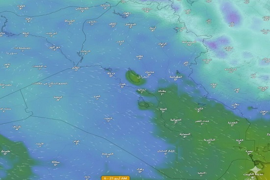
Stage One: A state of atmospheric instability will affect Iraq and neighboring regions on Sunday and Monday, January 18 and 19, 2026.
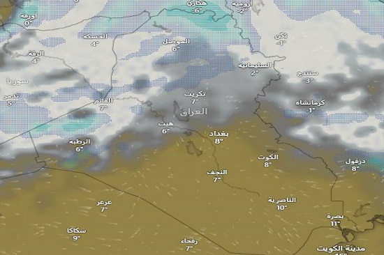
This instability, characterized by surface cold and heavy snowfall, is shown in the precipitation maps over northern Iraq (Duhok, Erbil, Sulaymaniyah, and Mosul), particularly over the highlands. Snowfall is expected over Al-Qaim and the northwestern areas of Anbar if the situation persists. If it intensifies, snowfall will cover all of Anbar. With a white scarf, As for Baghdad and the southern regions, temperatures will drop due to this polar low, but no rain is expected as the cloud cover recedes on January 20th, opening the way for the strong Siberian High.
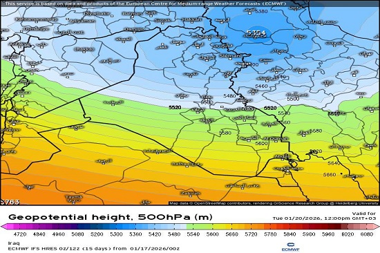
Stage Two: The Impact of the Siberian High and Stability Starting Tuesday, January 20, 2026.
The European model shows very low temperatures (below zero in large areas) with a complete absence of clouds in most parts of the country. This behavior is typical of the Siberian High. This is accompanied by a very cold and dry air mass of continental polar (Siberian) origin (Cp), pushing in behind the cold trough that left the country. This causes a "cold dryness" and frost, especially with the receding cloud cover, which increases the chance of radiative cooling, significantly cooling the ground surface, particularly during the night and early morning hours. The cold wave is intensified by northwesterly winds with speeds ranging from 20 to 35 km/h during the day.
The minimum temperatures as shown on the map. For the cold wave:
Mountainous region (far north): Extremely cold, reaching -20°C in very high elevations.
Northern region:
• Sulaymaniyah: -10°C
• Mosul: -3°C
Anbar (Western Desert):
• Rutba: -5°C
• Al-Qaim: -2°C
• Nukhaib: -1°C
• Haditha: 0°C
• Ramadi: 1°C
Central region:
• Baghdad: 1°C
• Kut: 2°C
Southern region:
• Basra: 5°C
• Nasiriyah: 3°C
#Upper_Euphrates_Center_for_Sustainable_Development_Research