| News Details |
The Upper Euphrates Center Announces the Publication of Water Level Forecast Maps and Flood-Prone Areas
2026-04-03
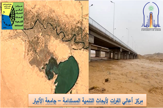
As part of its development plans aimed at enhancing meteorological data, monitoring climate change, and supporting researchers, specialists, and graduate students, the Meteorology Department at the Upper Euphrates Center for Sustainable Development Research – University of Anbar – announced the launch of a new service that includes publishing maps predicting water levels resulting from upcoming rainfall, as well as identifying areas likely to be at risk of flooding.
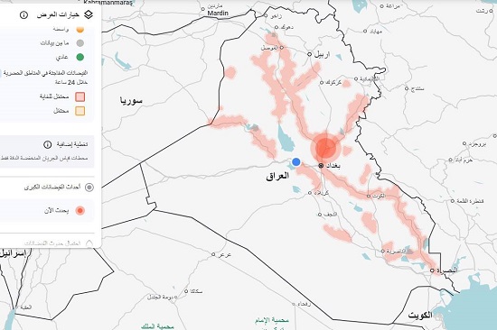
Assistant Professor Dr. Ahmed Jassam Mukhlif, Head of Satellite Meteorology at the department, explained that this feature has been included in the periodic reports and bulletins issued by the department. It provides an accurate and comprehensive picture of the impact of rainfall on the river's condition and water levels along its course, thus contributing to supporting analysis and decision-making processes for relevant authorities. The first map (based on numerical models) for the Tigris and Euphrates basins indicates the potential for rising water levels in the pink areas, depending on the expected rainfall in the coming days. The highest point is near Baghdad, to the north, which is the most critical point where the waterways converge, increasing the likelihood of a sudden rise in water levels.
Recommendations:
Stay away from riverbanks: Avoid low-lying areas, wadi beds, and floodplains.
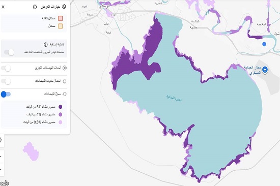
The second map, related to Lake Habbaniyah, shows the maximum water level previously reached by the lake... essentially, it's a map of historical risk. The colors you see at the edges (flood record) represent the frequency of inundation over many years of historical data:
The light blue area (center of the lake): This is the permanent body of the lake, which contains water most of the time.
Dark purple (5% of the time): This indicates that the land surrounding the lake is flooded during years of abundant rainfall (approximately once every 20 years, on average). Light purple (0.5% of the time): This indicates that these areas only receive water during very rare floods (once every 200 years).
Professor Dr. Ammar Hatem Kamel, Director of the Center, confirmed that these maps, known to specialists as "Flood Maps," are an essential tool in preparing emergency plans and enhancing early warning programs, given their significant role in reducing risks and minimizing potential losses resulting from floods and related disasters.
Dr. Haitham Abdul Mohsen Afen, Head of the Meteorology Department, pointed out that this step comes within the framework of implementing the strategic plans announced by the Meteorology Department, which aim to develop smart early warning systems. Work is currently underway to initiate these projects in cooperation with specialists in computer technology and artificial intelligence, which will enhance the efficiency of response to climate challenges and extreme hydrological phenomena.
#Upper_Euphrates_Center_for_Sustainable_Development_Research