| News Details |
Weather Forecast for Iraq for the Next Few Days
2026-04-11

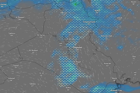
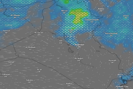
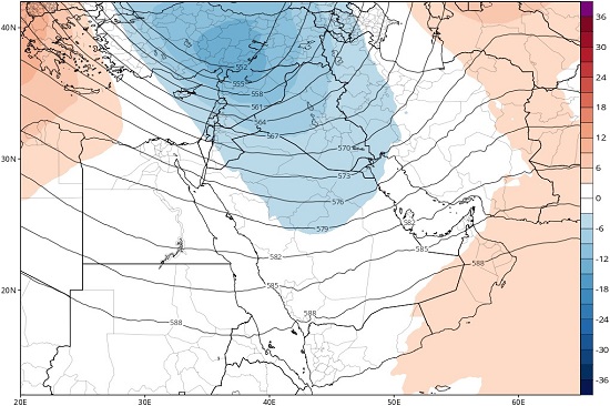
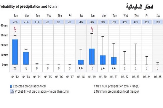
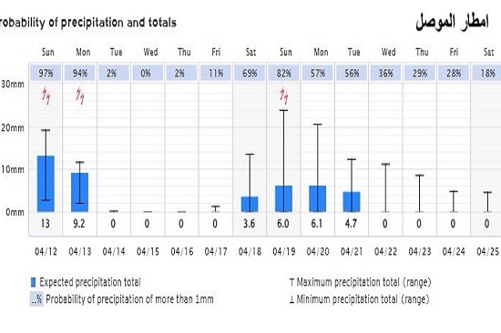
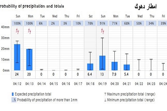
The Meteorology Department at the Upper Euphrates Center for Sustainable Development Research - University of Anbar announced updated weather conditions based on satellite imagery. Assistant Professor Dr. Ahmed Jassam Mukhlif, Head of Meteorology at the Center, stated that according to the outputs of the European Meteorological Model (ECMWF), scattered rainfall is expected in Iraq from Saturday until the end of Monday, April 11-13, 2026, Allah willing. This is due to a break in part of the jet stream and Iraq falling under a cold trough at the 500 millibar level, leading to the formation of a cut-off low. As follows:
The northern region (Nineveh, Sulaymaniyah, Dohuk, and Kirkuk) is the most affected by the combined low-pressure system, with cold weather, significant cumulonimbus cloud activity, and thunderstorms with rain. Temperatures will be low, ranging between 10–16°C. Winds (westerly to northwesterly) will carry cold air from the north and northwest.
The central region (Baghdad, Tikrit, Anbar, Diyala) is a transitional zone between the cold air mass to the north and the warm air mass to the south. There will be scattered clouds and a chance of light rain in Tikrit and Anbar (Heet, Al-Qaim, Rutba, and Fallujah). Rain will be limited and intermittent, but may be heavy in Diyala and Baghdad. Temperatures will vary considerably, ranging between 17–26°C. The southern region (Najaf, Basra, Amarah, Samawah) will have relatively stable weather, with scattered high clouds. Basra, Amarah and Nasiriyah may be affected by the humidity of the Gulf with the accompanying weather disturbance, leading to moderate to heavy rainfall on Sunday, Allah willing. Temperatures in the southern region will be relatively high, between 26–32° Celsius.
#Upper_Euphrates_Center_for_Sustainable_Development_Research