| News Details |
Monitoring a group of small dams via satellite in the western region and the extent of the impact of the recent rain wave on them
2024-12-05
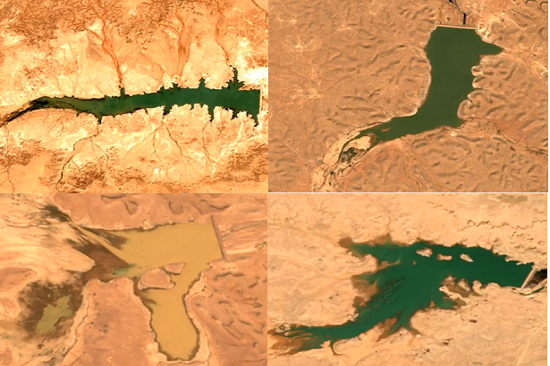
Within the program of the Upper Euphrates Basin Developing Centre at the University of Anbar, to study and monitor climate change and meteorology, the Planning and Databases Department at the Centre announced a set of satellite images taken by the European satellite of a group of small dams in the western region and the extent of the impact of the rain wave at the beginning of November on water storage.
Engineer Ahmed Ismail Odeh said that the pictures of the Rahaliya Dam reflect the development of the concept of investing the water of the Rahalia Dam in supporting economic activity in the region, as the spread of wheat fields irrigated by sprinklers and large areas led to the discharge of the dam's water and then the dam returned to fill again as a result of runoff from the recent wave of rains, which gives a typical example of what the water harvesting system and farms in desert or remote areas in Anbar province and the integration of dam projects with small and modern irrigation methods with agriculture, economy and achieving sustainable development goals.
The pictures of the dams (Al-Abila, Shabija and Horan 3, and Al-Rutba Dam) indicated a great possibility to re-experience the Rahaliya Dam in these dams and invest the surrounding and near areas for the purpose of establishing farms for important strategic crops and supporting the economy and development in the region, which is what the Upper Euphrates Basin Developing Centre seeks and with the support of the University of Anbar within its strategic plan to achieve the sustainable development goals within Vision 2030.
To see the satellite image of the Rahaliya Dam ... Click here.
To see the satellite image of the Horan Dam... Click here.
To see the satellite image of the Rutba dam ... Click here.
To see the satellite image of the Abila Dam ... Click here.
#Upper_Euphrates_Basin_Developing_Center